How Perennial Provides MMRV Anywhere
Learn more about the tech, science, and workflows that power Perennial.
Validated.
Adaptable.
Built to scale.
We combine peer-reviewed science, digital tools, and trusted partnerships to help project developers and sustainability teams quantify regenerative outcomes with precision, scalability, and confidence.


An optimized foundation for every project
MMRV that adapts to meet your project’s needs
Learn more about the monitoring approaches below.
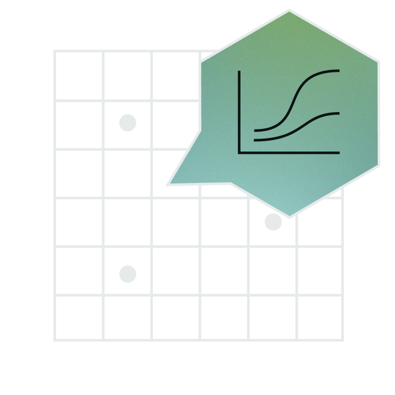


Enhancing accuracy & efficiency with Digital Soil Mapping
Digital soil mapping (DSM) is a low-sample, low-cost, low-uncertainty approach that scales across geographies, land types, and crops.
By quantifying all of the soil in a project rather than scattered points, and modeling uncertainty at a pixel level, DSM reduces uncertainty, lowers sampling needs, and strengthens accuracy.
Whether used on its own, alongside a biogeochemical model (BGCM), or as the destination for projects starting with point sampling, digital soil mapping is an upgrade for any soil carbon project.
+ High accuracy
+ Lower sample burden
+ Higher credit yield
+ Registry-aligned* (e.g. VM0042, VM0032, and more)

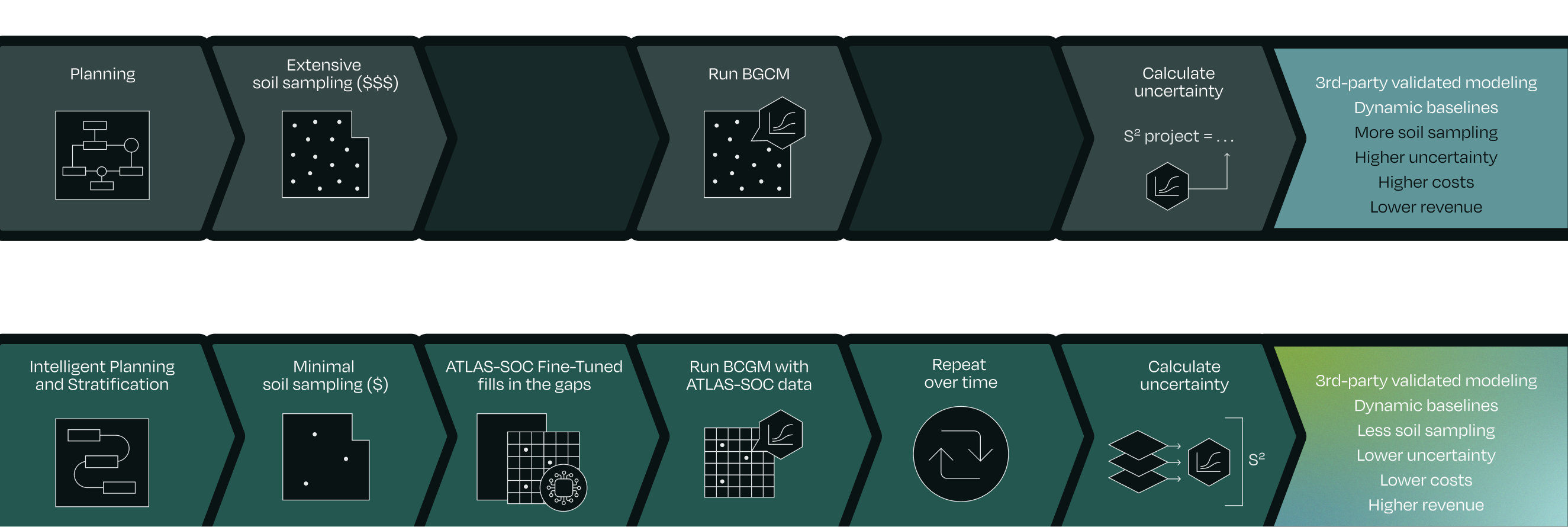
Digital Soil Mapping + Biogeochemical models
For projects already using biogeochemical models (BGCM) — or starting in crops and regions where they’re well-validated — digital soil mapping strengthens results while reducing reliance on dense sampling.
By filling in the gaps between and beyond sample points, DSM provides spatially rich SOC data that sharpens model calibration and minimizes assumptions.
Even when working with 10x fewer samples, we can generate up to 20x more SOC inputs for the biogeochemical model. Combined with pixel-level uncertainty modeling, this leads to sharper estimates, lower uncertainty, and greater confidence in results.
How it works:
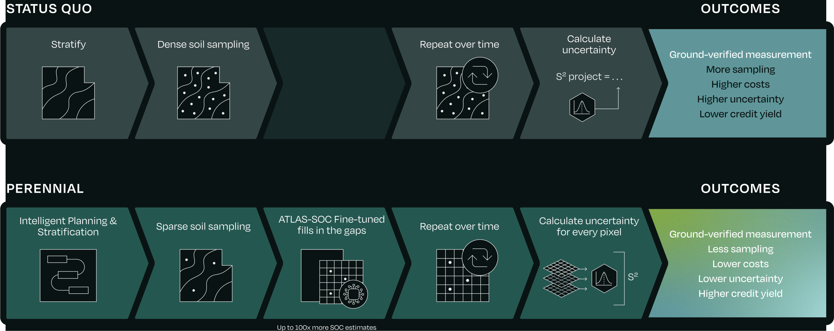
From Measure/Remeasure to Digital Soil Mapping
Projects that begin with measure–remeasure often face high sampling costs, operational complexity, and limited spatial resolution. Transitioning to digital soil mapping changes that.
By applying our digital soil mapping model to your existing samples, we can generate hundreds to thousands more SOC estimates — filling in the gaps between sample locations, modeling uncertainty pixel by pixel, and dramatically expanding coverage without resampling.
The result: lower uncertainty, lower costs, and a stronger foundation for future crediting.
Transitioning doesn’t mean starting over. It means getting more value from the data you already have — and unlocking a path to greater efficiency, scalability, and confidence.
How it works:
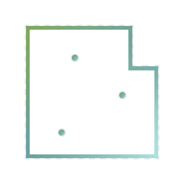
Starting with Measure-Remeasure
Perennial supports measure–remeasure when needed — particularly in early-stage projects or regions with limited data. Even with a samples-only approach, our optimized foundation helps reduce the sampling burden and streamline operations from day one, with improved stratification, QA/QC, end-to-end traceability, and more.
Each measurement event helps build a dataset that can support a future transition to digital soil mapping — preserving compliance while lowering cost and complexity.
+ Start where you are
+ Evolve toward digital soil mapping
+ Improve performance at every stage
→ Peer-reviewed paper on quantifying SOC using digital soil mapping
→ Peer-reviewed paper on calculating SOC beneath the soil surface
→ Perennial Soil Ecosystem Data technical documentation
→ AGU presentation on estimating sequestration potential with SOCSPOT
→ Correspondence in Nature on verifiability of soil carbon credits
Verra’s Digital Soil Mapping tool: built by Perennial
Developed with a global team of experts and shaped through public consultation, the tool is the first AI-enabled carbon quantification tool to be recognized by a major registry. VT0014 allows digital soil mapping to be used across the Verified Carbon Standard — for any ALM methodology that requires a SOC estimate, bulk density, or SOC stock.
Thousands of hours of research, testing, and stakeholder input went into its creation — helping unlock rigorous, scalable, registry-grade MMRV anywhere.

Meet ATLAS-SOC
Peer-reviewed, and third-party validated, ATLAS-SOC has now integrated over 350,000 soil samples.
Trusted by market leaders


Frequently asked questions
Do you still use soil samples?
Is digital soil mapping the only approach you use?
Can I use Perennial if I already work with a biogeochemical model?
What happens if my project starts with measure–remeasure?
What kinds of projects can Perennial support?
Which standards and registries are you aligned with?
How do you ensure measurement accuracy and traceability?
How do I know which monitoring path is right for my project?
How do you support projects in data-scarce or underrepresented regions?
What makes Perennial different from other MRV providers?
Does this work in smallholder farms?
Can digital soil mapping be used in my country?
Are there minimum project sizes to use digital soil mapping?
Explore how Perennial can support your project


